
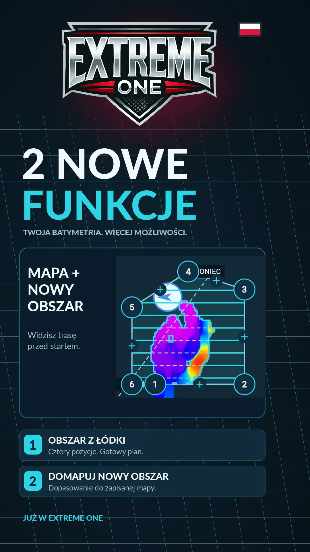
Mapping from the boat and filling in an area: two new features
Mapping from the boat and fitting a new area to existing bathymetry make collecting measurements easier. You can mark the corners by driving the boat, or fill in a missing part of the map without rescanning the whole surface.
Four corners saved from the boat’s GPS
- Open Mapping, choose Four corners, then Boat.
- Drive to the first corner and save the point from the boat’s current GPS position.
- Repeat for the second, third and fourth corners.
- Check the outline and the planned lanes. Only Start launches the mission.
Defining an area this way is useful when it is easier to judge its boundaries while driving than by dragging the map with your finger. The app shows a preview before the boat receives the mapping plan.
Filling in a missing section
Choose Custom outline and mark the new area. If the polygon overlaps a place already covered by bathymetry, the app will ask whether you want to rescan the whole area or fit the area to the saved map.
After choosing Fit area, you will see a corrected lane plan for the missing section. You check it, and only another tap on Start launches the mission. Automatic fitting applies to polygon mapping, not to Four corners mode.
The decision stays with you
You can deliberately repeat a measurement or use the earlier map to limit the new area. In both cases the saved sonar recordings remain available for later analysis. The video shows both features in the app.
Mapping from the boat: boundaries first, then the mission
Saving corners while driving makes it easier to define an area you can see from the bank. You can bring the boat to a place you recognise on the water and save its position. In this way you build the plan from successive GPS points. Adding a point does not start an automatic run on its own. Before starting, you can still look at the whole outline and the lanes laid out inside it.
It is worth starting mapping from the boat by thinking about which part of the lake you want to get to know. If you are interested in the transition from a plateau to deeper water, include both sections and the link between them in the plan. Too small a section may show just the depth difference without its surroundings. On the other hand, a larger area means a longer run, so it is best to match it to the specific purpose of the trip.
Four corners and custom outline are separate methods
Four corners mode is a simple plan defined by saved positions. The user drives to successive places and creates the boundaries of the area. Custom outline lets you mark a polygon on the map and fit it more closely to the shape of the missing section. The choice depends on whether it is more convenient to define the area while driving or to draw it on the screen.
Automatic limiting of overlapping areas is tied to the polygon. Mapping from the boat using four corners keeps its existing planning method. This is important when watching the video: we show two features that can be used in different situations. There is no need to look for the fit button in a mode it was not designed for.
Filling in an area next to earlier measurements
Suppose you already have a map of part of the fishery, but runs are missing along its side boundary. You mark a new polygon, part of which overlaps the saved area. The app recognises the shared section and gives you a choice. You can keep the repeat measurement or accept a correction that takes the existing coverage into account. This way you decide yourself whether the overlap is intentional.
Repeating a scan can make sense when you want to compare readings or check a particular swim again. Fitting is useful when you want to fill in missing ground. In both cases you look at the plan before sending the mission. Pay attention to its boundaries and the course of the lanes, especially when the newly marked area has an irregular shape.
How to check the result after the run
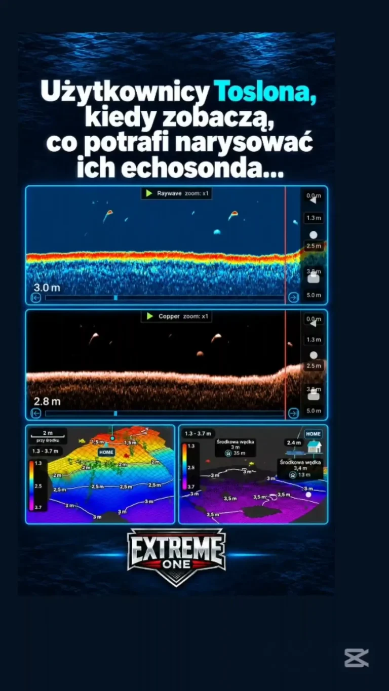
Mapping from the boat ends with collected material that you can return to in your saved scans. Look at the new section together with the earlier map. Check whether you covered the drop-off you were interested in and whether any places still need another measurement. A clear recording name and the date make analysis easier, especially if you return to the same lake after a long break.
You do not have to plan a survey of the whole lake straight away. You can get to know it in stages, filling in further parts as needed. Mapping from the boat helps you define the initial area, and polygon fitting keeps later expansion of the coverage tidy. The saved sonar recordings also let you go back to the raw readings and check a detail that needs a closer look on the overview map.
 Karpik Kroczek, asystent Extreme One