
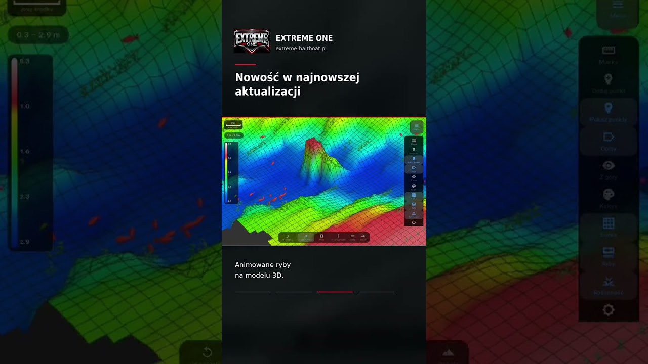
What a gully! A 3D bottom scan from an Extreme One user
Look at the beautiful gully an Extreme One user has found! It is another 3D bottom scan sent in by an angler who decided to show what he managed to create. The model shows the channel in all its glory: its bottom, the clear edges, the slopes and the neighbouring shallows.
The gully on the 3D model
From the bank this part of the lake looks like any other stretch of water. Only the model from the fish finder reveals that a channel runs beneath the surface, an elongated depression which is a natural route for carp to move along. Fish like to travel along the edges, looking for food that has collected on the slope and at the foot of the drop-off.
We are not revealing the name of the lake or its location. The spot stays with the author of the scan, and a big thank you for sharing the footage!
Where to place your rig by a gully
We asked this question under the video and the answers vary. Each of the three spots has its own arguments:
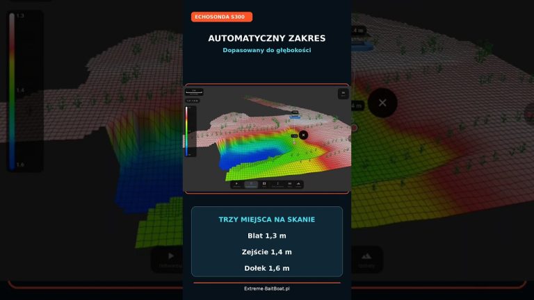
- bottom of the channel – the deepest, often the calmest part, good on cooler days,
- edge of the channel – the classic feeding route where fish pass most often,
- shallow next to it – warms up faster and is often a dining table on warm days.
A 3D model will not make the decision for you, but it shows all three options at the same time. Instead of guessing where the drop-off begins, you see it directly. You can measure the difference in depth between the edge and the bottom of the channel with the 3D ruler, which calculates the distance along the shape of the bottom.
Animated fish in the visualisation
The video also shows the animated models of detected fish in Extreme One. Fish detected by the fish finder during the scan are no longer motionless icons: they swim and turn around, which brings the visualisation of the 3D bottom scan to life and makes it easier to see in which part of the channel the most fish gathered.
How to make a 3D bottom scan like this
For a scan like this you need a fish finder that gives a full picture of the bottom, for example the EXTREME-MASTER SONAR S300, and the EXTREME-PILOT autopilot, which drives the boat in even, repeatable runs. The more densely you cover the lake, the more clearly the channel and its edges will appear on the bathymetry map. You can then share your scan with others, as we described in the article on bathymetry sharing.
How to fish a gully
Finding the structure is half the success, the other half is using it sensibly on the water. A few practical tips that work well in spots like this:
- bait along the edge, not across it, so that the bait forms a path the fish follow anyway,
- remember that boilies dropped over a slope roll down, so deliver them slightly higher than where you want them to end up,
- if you fish with several rods, spread them over different depths: on the bottom, on the edge and on the shallow next to it,
- watch which rod produces the bites and after a few hours move the others to similar spots.
Why we share our users’ scans
Every scan sent in is proof for us that the system works on real waters, in the hands of anglers, and not just at demonstrations. We show this material with the authors’ consent and without revealing locations, because a good spot is something every carp angler protects.
Examples like this also help others learn to read the bottom. Many people see for the first time what a depression really looks like, one they previously knew only from stories or from single depth readings.
Frequently asked questions about gullies in a lake
How do you recognise a gully on a 3D model?
A gully is an elongated depression surrounded by higher parts of the bottom. On the 3D model it appears as a darker band in the depth palette, bordered on both sides by clear edges and slopes.
Can you find a channel like this without a 3D model?
You can feel it out with a marker float or read it from single passes of the fish finder, but it takes much more time. A three-dimensional model shows the whole course of the channel at once, together with the places where it narrows, widens or joins a shallow area.
How many passes are needed for the channel to be clearly visible?
It depends on its width. With a narrow channel the spacing between passes should be smaller than its width, otherwise the app will smooth it out during interpolation. The autopilot helps keep the lines even and dense.
Do the animated fish show fish in real time?
The animated models show fish detected by the fish finder during the scan. It is a visualisation of the recorded data, not a live view, but it clearly shows in which places of the channel the fish gathered.
Have an interesting scan and want to show it? Write to us or leave a comment under the video on our YouTube channel.

 Asystent pomocy Extreme One