
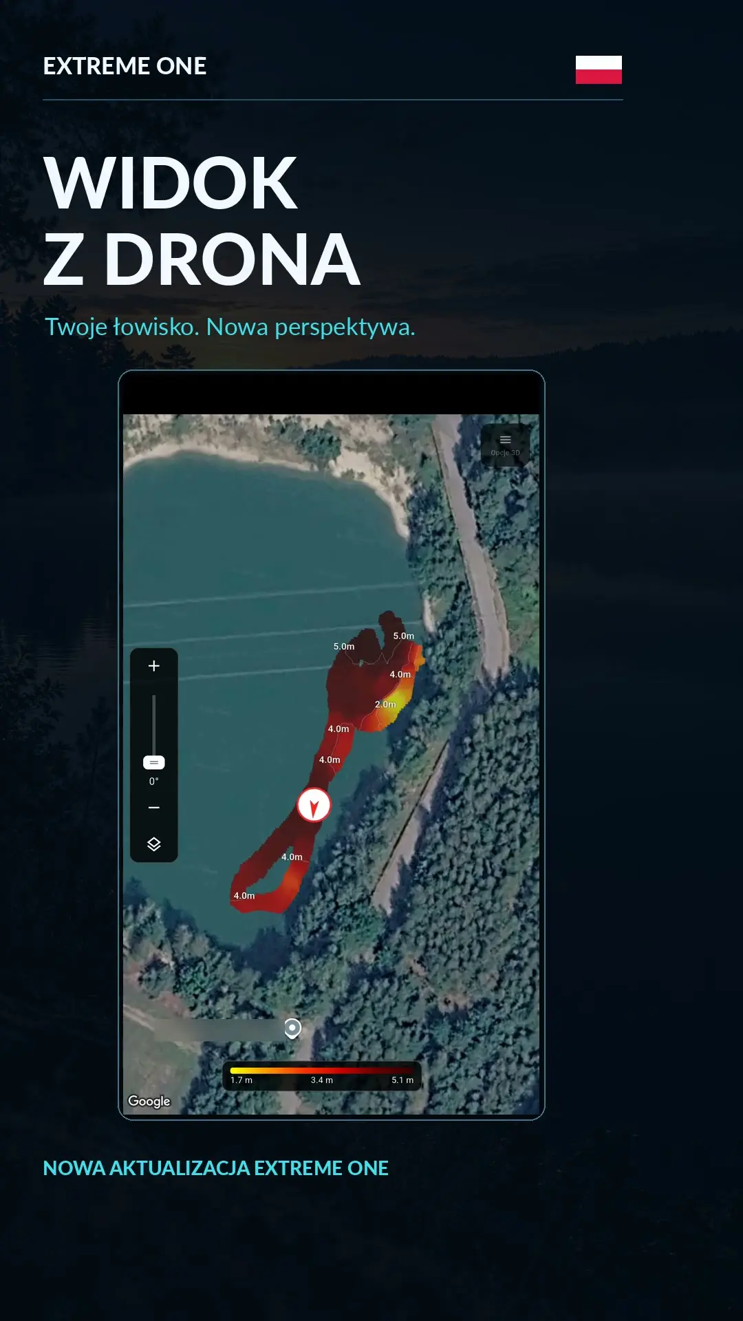
Drone view: tilt the map and return to an interesting spot on the sonar recording
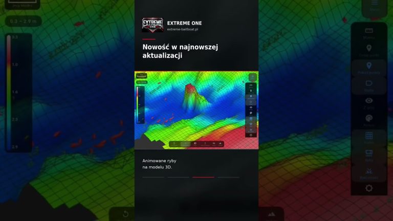
Drone view gives you a new perspective on a saved fishery. You tilt the satellite map together with the bathymetry and rotate it to look at the depth layout from above, at an angle or from the other side.
Camera and bathymetry on one map
In My scans, turn on camera control from the view menu. On a phone or tablet, a slider lets you adjust the tilt. Rotating the map with a gesture helps you look at edges and at where interesting parts of the bottom lie relative to the bank.
Scroll the sonar recording and follow where the reading was taken
By moving the sonar recording history left or right, you return to the chosen moment of the recording. The boat marker shows on the map the position saved for that part of the scan. This makes it easier to link an interesting return to a specific place on the water.
If you notice a drop-off or a hump, you can save a point from the section you are analysing, give it a name and use it on your next trip. So analysis at home can produce a new swim even when the boat is already in the garage.
Your scans on different devices
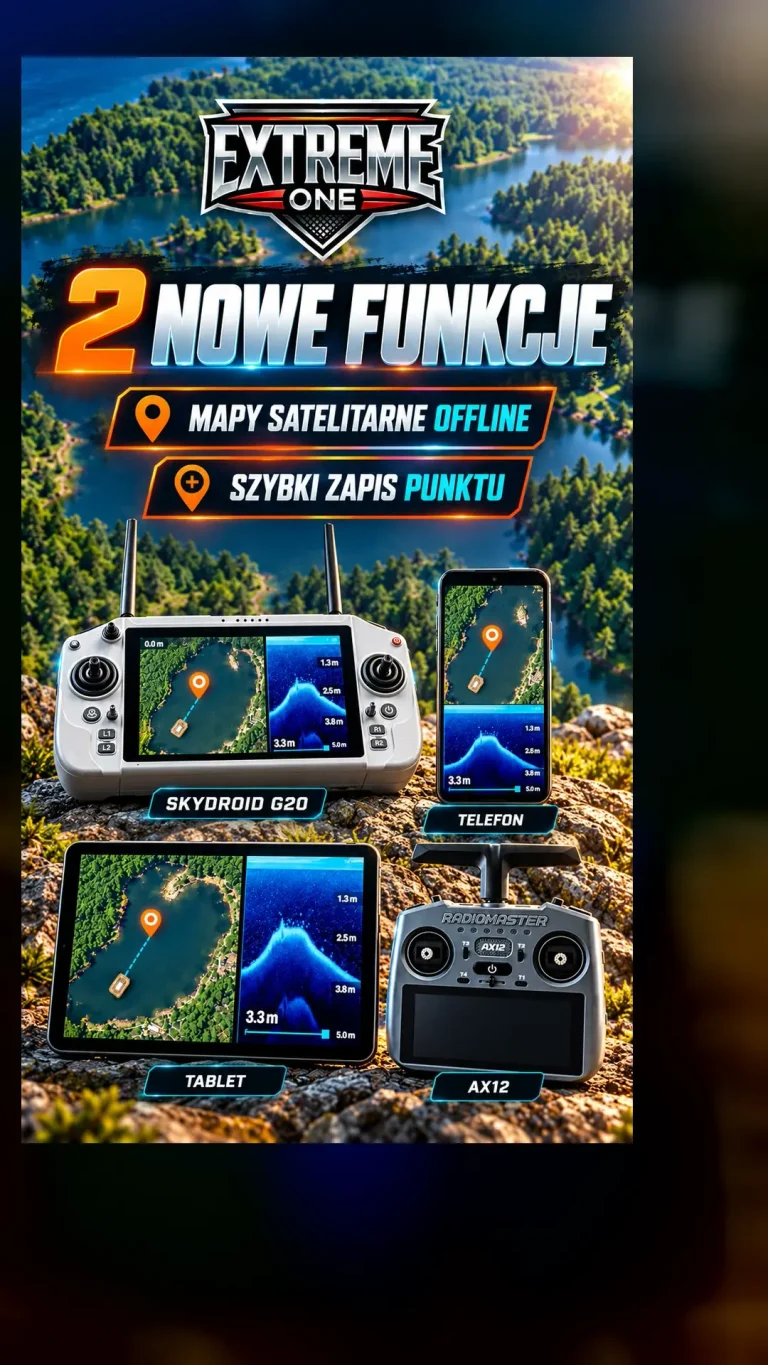
After uploading the data to the cloud and logging in to the same account, you can analyse saved scans on a phone, tablet or transmitter. The video shows the operation step by step. First you collect data on the water, then you come back to it at a convenient time.
Drone view: a convenient order for looking at a fishery
Start by positioning the camera above the map. From this perspective it is easy to see where the surveyed section lies relative to the bank and saved points. Check the legend and the depth range, and only then lower the viewing angle. Moving to a lower perspective is then clear, because you already know which part of the fishery you are looking at and where the interesting spots are.
Drone view lets you tilt the map and rotate it to look at a chosen section from another side. You do not have to choose the lowest angle straight away. Sometimes a moderate tilt shows the layout of an area better, while a top-down view makes it easier to judge distances on the map. It is worth matching the perspective to the question you are trying to answer.
2D bathymetry on a satellite base map
The satellite base map helps you recognise the surroundings of the lake, while the depth layer comes from measurements. By looking at both together, you can relate a drop-off or shallow area to the line of the bank. The colour of the water in the photo does not replace a sonar reading. So when judging depth, use the legend and map markings, and treat the photo as an aid to orientation.
Drone view keeps the bathymetry tied to its place on the map. Rotating the camera changes how you look at it, but it should not be confused with a new measurement. This is especially useful when you show someone a fishery: first point out the bank and the swim, then move to the interesting section. That way it is easier to understand the whole layout, not just a coloured fragment.
Analysing a sonar recording step by step
Move the history to the place that caught your attention. Look at the bottom profile before and after the return, rather than judging one column in isolation from its neighbours. The boat marker helps you relate this section to the saved position. If the recording contains GPS data, you can link the reading to a specific part of the run visible on the map.
When you save a swim during analysis, pay attention to the selected moment in the history. It is the position from the recording that matters for the section of bottom you have found. Give the point a name that will help you remember later why you saved it. A short note about a drop-off, a plateau or a place to check again is often more useful than yet another point without a recognisable description.
Drone view at home and on the water
On the water you often concentrate on steering the boat and collecting data. At home you can spend more time comparing neighbouring sections of the scan. The saved history lets you return to the same place many times, and changing the camera angle makes it easier to show it to someone else. That way the analysis does not have to end when the run is over.
Before switching to another device, finish synchronising the recordings you need. Then log in to the same account and open the right material. Drone view is one of the tools for viewing it, alongside the sonar recording and the other maps. They work best together: first orientation on the lake, then reading a specific section and finally saving an observation that will be useful on your next trip.
See also
Extreme One for Android: sonar scans and 3D lake maps anywhere
 Karpik Kroczek, asystent Extreme One